300 days of sunshine a year
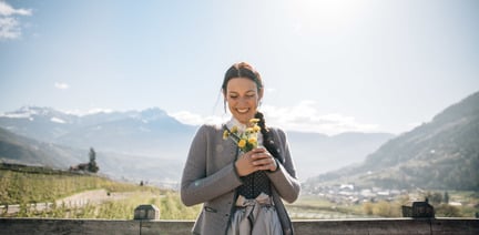
Sunny prospects in Algund

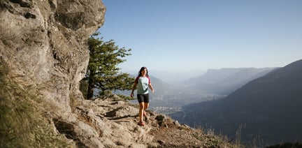
The starting point of this beautiful mountain tour is the Leiter Alm mountain hut that you can comfortably reach by taking the chair lift from Algund/Lagundo and the gondola basket lift from Vellau/Velloi. First hike along the Meraner Höhenweg high alpine trail no. 24 westwards until the Hochganghaus refuge (1,839 m) and continue along the steep, exposed trail no. 7 secured with ropes and chains up to the Hochgangscharte pass (2,455 m). From there, trail no. 10 leads eastwards to the Rötelspitze peak (2,625m). Take the same route to return to the Leiter Alm mountain hut (trails no. 10, no. 7 and no. 24). Hikers with a good physical condition can also choose a slightly longer descent: From the Hochgangscharte pass, trail no. 7 leads above the Langsee lake and later meets trail no. 22 that takes you past the Grünsee lake down to the Oberkaser Alm mountain hut. Continue along trail no. 22 past the Kaserlacke and the Pfitscherlacke lakes until the junction with trail no. 25B that you follow up until the Taufenscharte pass (about 100 metres of altitude difference). Descend along the rather steep trail with serpentines until you meet trail no. 24 (Meraner Höhenweg high alpine trail) and follow it until the Leiter Alm mountain hut, where you take the gondola basket lift to Vellau/Velloi and then the chair lift or bus back to Algund/Lagundo.
Through the Adige Valley to Algund and from there to Vellau.
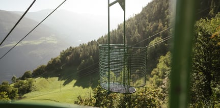
At the valley station basket lift in Vellau
By train to Algund and further by bus 235 to Vellau.


The Spronser lakes are located at the centre of the Texel Mountain Nature Park, one of the largest high mountain lake districts in the entire Alps. They are filled with ...

High above Partschins/Parcines sits the well-known local mountain of Partschins/Parcines, the Zielspitze summit!
The three-thousand-metre peak is the first peak in ...