300 days of sunshine a year
Sunny prospects in Algund

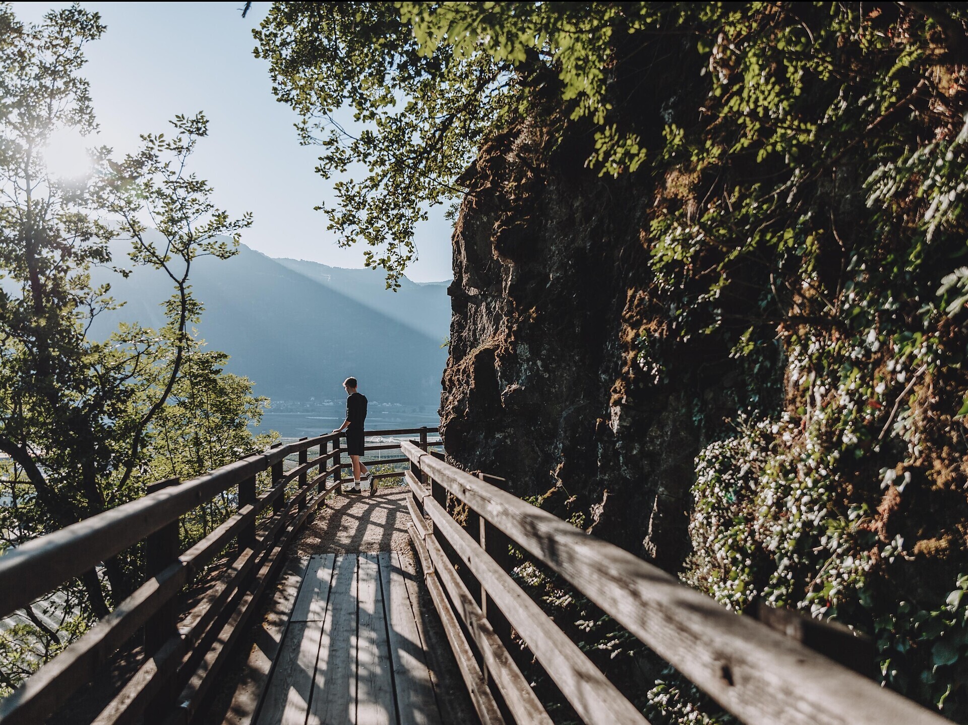
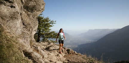
The leisurely walk along the irrigation channel crosses the foothills of the Ortler Alps on its panoramic path between Oberlana and Niederlana.
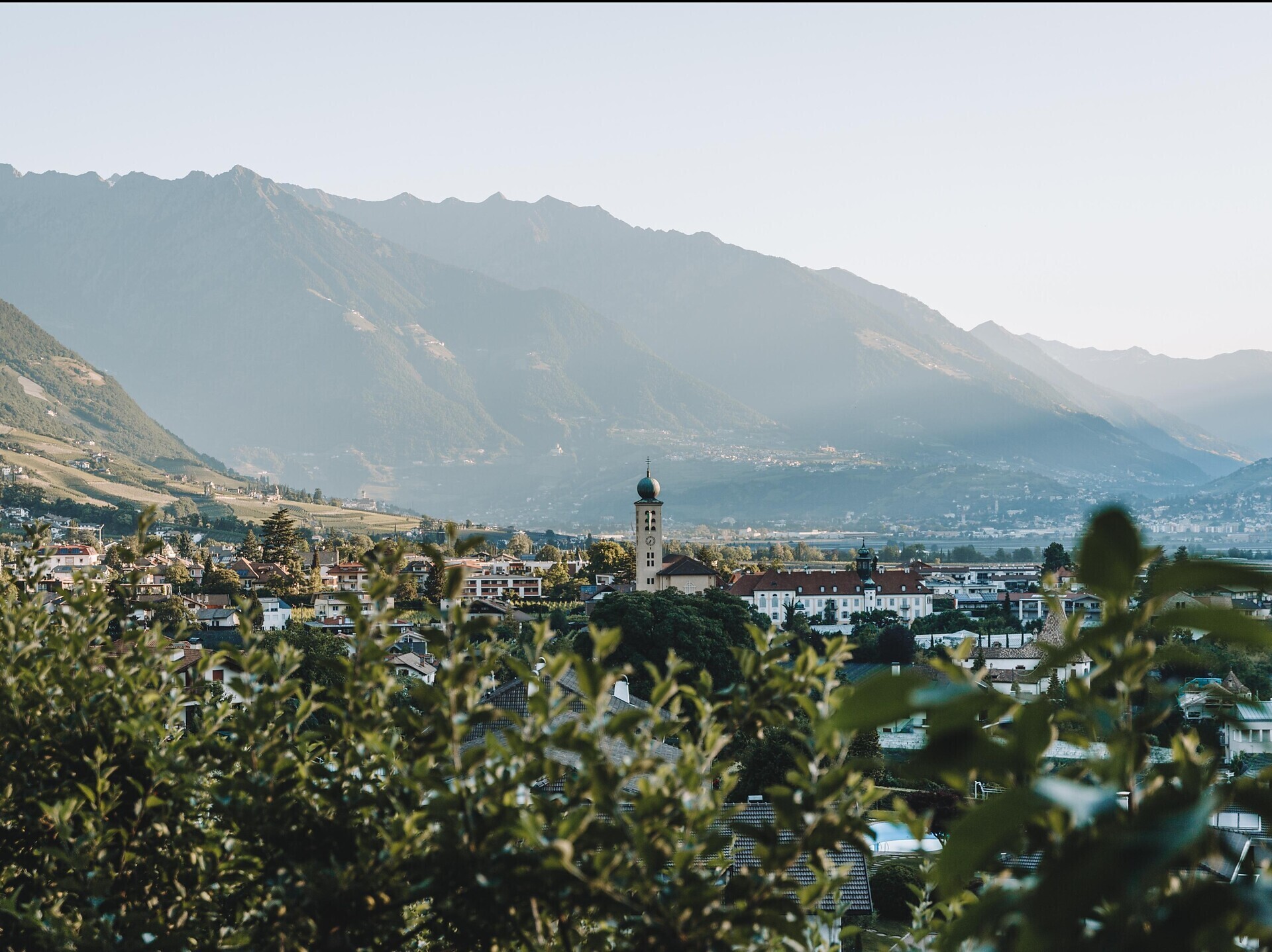
From the first days of spring until late autumn, the Waalwege, as the paths along the old irrigation channels are called, offer magnificent views of the mountains and the Adige Valley, but also exciting insights into a varied cultural landscape. The ancient irrigation channels are one of the most atmospheric walks in South Tyrol. They gently run through vineyards, apple meadows and chestnut groves along the low mountain ranges.
The narrow paths were originally created for purely practical reasons. The irrigation channels, called "Waale", were built in the pre-industrial age to irrigate fields and meadows thoroughly. For kilometres the water was led through small canals. The Waalweg along the canals, on the other hand, was used by the Waalermeister for maintenance.
From Lana, two irrigation channels in Merano and the surrounding area are easily accessible: The Brandis-Waalweg and the Marlinger Waalweg.
The Brandis-Waalweg takes a left from the Gampenstraße Road in Oberlana and leads via the monastery Kloster Lanegg and St. Margareth's Church to the waterfall in the Brandis Canyon in Niederlana. The path runs through orchards, vineyards and chestnut groves and offers beautiful views of the Tschögglberg Mountain, Lana and the Meran Valley Basin.
Circular walk: From the Brandis promenade in Niederlana, immediately after the wooden bridge to the waterfall (near the Waalrast restaurant), a new circular walk begins to the right of the path. The path leads us uphill (towards Völlan) to the big crucifix. Beautiful panoramic view of the Adige Valley. To return, take route no. 1 (Lana-Völlan) and descend towards Niederlana until you reach the Brandis promenade (above the fruit tree museum). Duration: approx. 30 min.
Difference in altitude: approx. 200 m
From Merano direction Lana to the centre of Lana
Several parking possibilities in Lana
Bus line 211 (Lana-Meran), Bus line 214 (Lana-Völlan), Bus line 215 (Citybus Lana), line 218 Lanabus, Bus line 245 (Meran-Lana-Ulten), Bus line 246 (Meran-Lana-Gampenpass)You can find current timetables at: www.suedtirolmobil.info
None, also suitable with boarding or low hiking boots. Orientation without problems, as a rule also possible without map.